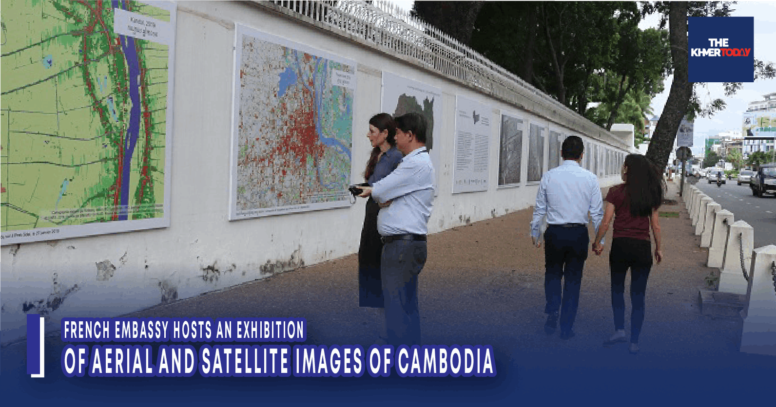
French Embassy Hosts an Exhibition of Aerial and Satellite Images of Cambodia
Phnom Penh, November 08, 2023 --
To mark the 70th anniversary of Cambodia's independence, the French Embassy is presenting an exhibition looking back over 70 years of total 30 aerial and satellite images, selected by the Institute of Research and Development (IRD), according to the embassy’s press release AKP received this afternoon.
These photographs dating from the 1950s to the present day. These aerial shots bear witness to the transformations of Cambodia's territory over the decades, offering a new perspective on the country's evolution.
The exhibition will be on view from Nov. 8 on the walls of the French Embassy in Cambodia, Monivong boulevard, Phnom Penh.
Active in Cambodia for almost 20 years, the IRD has set up in-depth academic and institutional partnerships with the country's key institutions to respond, through innovation and the development of new technologies, to the challenges of sustainable development such as climate change, loss of biodiversity, pollution, food security linked to sustainable agriculture and global health in an approach that integrates the environment. Earth observation, based on the analysis of images acquired by sensors embarked on aircraft, satellites or drones, makes it possible to describe and monitor natural resources, their organisation and their changes. The IRD develops and uses digital tools and innovative models for image analysis, to obtain information on the evolution of landscapes.
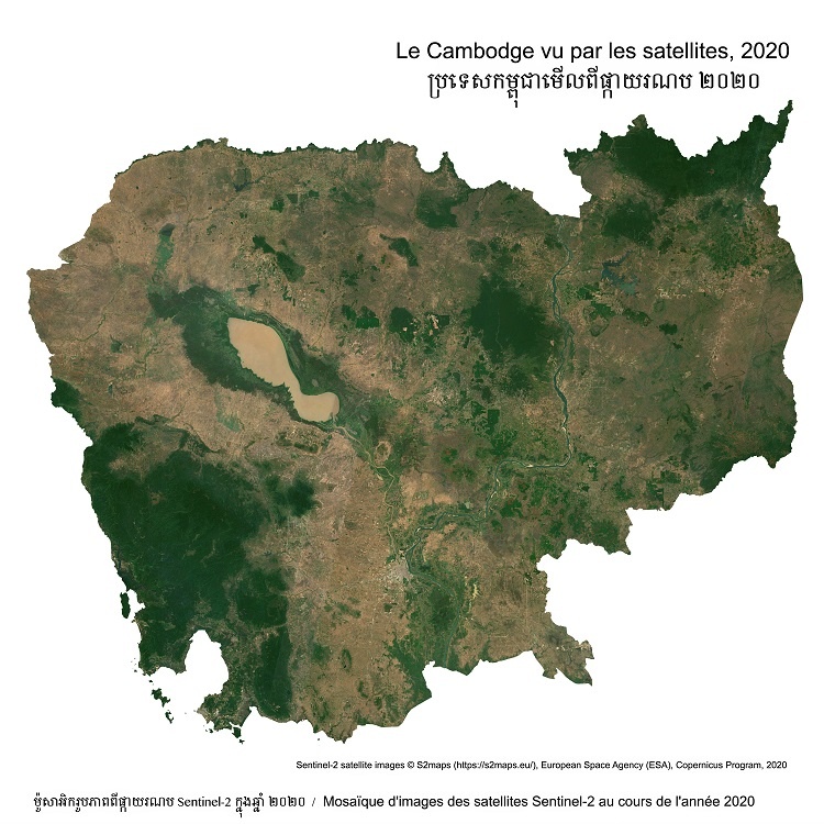
Since the first airborne images were taken in the 1950s, and then the first images from observation satellites in the 1980s, technologies have evolved enormously, with access today to a vast number of very high-resolution images. With the aim of developing Cambodia's capabilities in aerial and satellite image analysis and data access, the Institute of Technology of Cambodia (ITC) and the IRD have joined forces to create the Khmer Earth Observation Laboratory (KHEOBS) in 2022. Supported by French institutions and infrastructure, the KHEOBS laboratory has already brought together scientists and students from various Cambodian universities and institutions for thematic training workshops.
H.E. Jacques Pellet, Ambassador of France to Cambodia said KHEOBS is a laboratory of excellence that will train engineers and researchers and develop activities and projects using innovative Earth observation tools, both in Cambodia and at regional level. This project illustrates the quality of our scientific cooperation: few institutions in Cambodia had access to these technologies, he underlined.
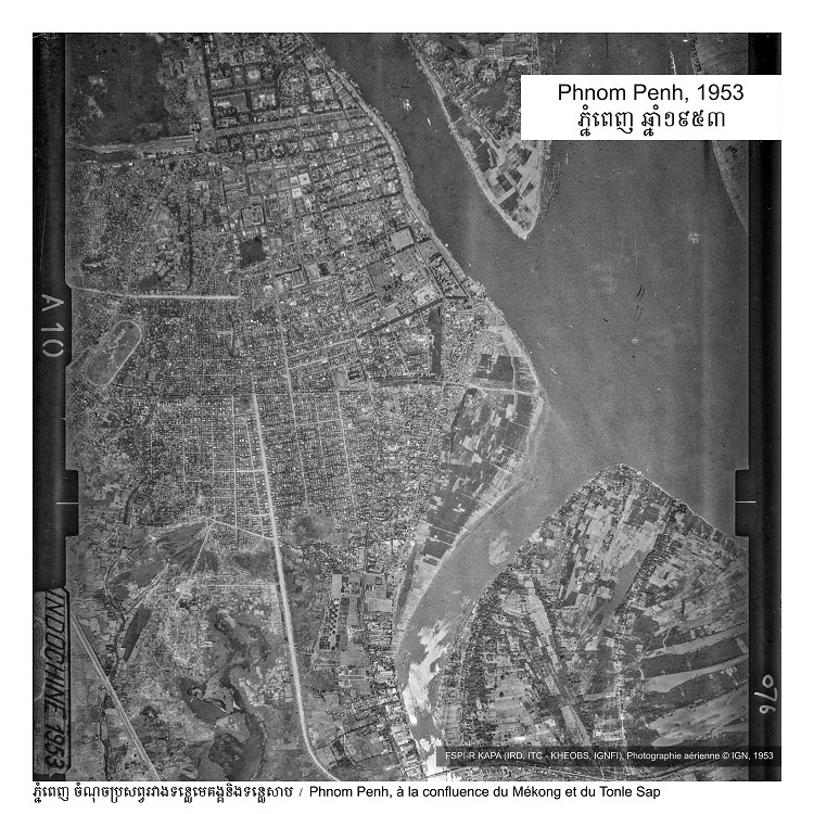
In the 1950s, France pioneered airborne photography with the Institut français de l'information géographique et forestière (IGNFI) to map its territories. In Cambodia, between 1952 and 1954, the IGNFI took some 11,000 shots, enabling a large part of the territory to be mapped. Today, this collection represents an exceptional archive that plunges us 70 years back into urban and rural landscapes. These archives are an invaluable resource on Cambodia's history, geography, archaeology, urban planning and environment. The French Embassy is supporting the "Khmer Aerial Photographic Archive" (KAPA) project, led by the IRD and the ITC within the framework of the KHEOBS laboratory, in collaboration with the IGNFI, so that it can be digitised and made accessible and usable free of charge for research. Once digitised, this photographic collection will be returned to Cambodia.
From the 1980s onwards, satellite imagery for remote Earth observation and remote sensing was developed, notably by the French Centre national d'études spatiales (CNES). The IRD has played a major role in designing analysis methods, so that these images can be used to understand the evolution of territories by measuring and analysing urban, agricultural and forestry trends. Our ability to process large volumes of data means that these images can be used to monitor environmental and hydrological dynamics, and to set up warning systems.
These images are supplemented by drone shots, which now make it easy to obtain highly accurate images repeatedly. New techniques for analyzing these images are being developed, making it possible to study soil evolution. These techniques offer Cambodia a wide range of applications to meet the challenges of environmental observation, in cooperation with various research organisations.
As part of the 70th anniversary of independence, the French Embassy in Cambodia is also offering a rich cultural programme with a series of conferences and a film series at the French Institute of Cambodia, as well as an exhibition at the SOSORO Museum.